This box was generously donated by Lone R of Canada for BABE https://www.atlasquest.com/events/event.html?gEventId=199TRIBUTEIn February 2001 the Van Loons, from Connecticut, posted Canada's 1st letterbox:
BEAVER MOUNTAIN PROVINCIAL PARK LETTERBOX, NOVA SCOTIA, CANADA
on the Yahoo letterboxing-usa list. You can still read the original clues:
http://groups.yahoo.com/group/letterbox-usa/message/5293?viscount=100
The box is still active and was adopted by Jiggs in 2007:
http://www.letterboxing.org/BoxView.php?boxnum=22230&boxname=Beaver_Mountain_Provincial_ParkThis tribute stamp was carved by Lone R from Guelph, Ontario in honour of the first letterbox planted in Canada and in honour of the US/Canada connection. The loon represents the planters, Christopher and Heather Van Loon. The loon is also one of the symbols of Canada and appears on our dollar coin (called a 'Loonie'). The beaver represents the provincial park where the box resides. Also, the beaver is the national symbol of Canada and appears on our 5 cent coin.Recommended colours: red, blue, black and brown for a multi-coloured stamp.DIRECTIONSFrom Asheville take I-40 W
Take Exit 7 (Harmon Den)
Take the gravel road right off the ramp toward Harmon Den (Hwy 148)
It's 9 miles to Max Patch from the beginning of this road.
Continue on Hwy 148 following signs to Max Patch.
When Hwy 148 ends in a "T", turn left on Max Patch rd (Hwy 1182)
Follow it until you see the large sign "Max Patch" where the parking is.
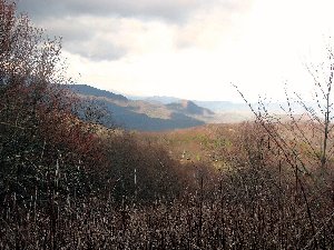
HIKEThis less than one mile round trip to the box. The hike is a fairly gentle uphill grade. If you hike to the top it's just over a mile round trip. The last .1 to the top if you want to go up is a considerable steeper grade. The clues will not take you this far. Elevation gain from the bottom of the trail to the top is about 200'. If you hike to the top you will be at 4629' and get one heck of a view!
RECOMMENDATIONSIt's windy up there since there's no trees or anything to act as a barrier.
Dress appropriately so you ears don't get cold.
Take a kite with you and fly it off the top if you like.
*TAKE A CAMERA*
There's no restroom facilities so plan accordingly (there's some back at Harmon Den camping area but that's about 9 miles back if you are at Max Patch).
CLUESGo over the stile and take the path to the left.
Hike until you see a spur trail on the right leading to a brown post saying "Open to hikers only".
From the post look NE
8 steps away is a log.
The box is at the backside of the log at the knot.
Comments: You may leave public online logs. No spoilers please.
Hike Length: 0.7 miles
Elevation Gain: 150 feet