Box #12815
Coyote Ridge 


Fort Collins, CO
| Planter | No No Girls Brother (owner)    |
|---|
| Planted | February 26, 2006 |
|---|
| Modified | November 5, 2011 |
|---|
| Keywords | planterschoice |
|---|
| Name | | Last Found |
F-Summary |
Findability |
|---|
| 1. | Coyote Ridge by No No Girls Brother | unknown | Aug 7, 2010 | fffFffxfxx | challenging |

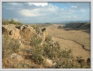
This letterbox is located south of Fort Collins and north of Loveland. The hike is about 1.6 miles one way with an elevation gain of approximately 500 feet.
I have received feedback from some letterboxers suggesting the hike is longer than 1.6 miles. My estimate is based on a trail guide, and I believe it is correct. The full Rimrock Trail is 7 miles round trip, but you reach the letterbox location roughly halfway along the trail.
If you have small children, decide whether to make this hike based on how your kids have done on other hikes. The hike to the box is basically uphill. I have seen many children of a variety of ages along the trail and in the area near the letterbox location, and I have received several e-mails from letterboxers who took their children along and had a great time. However, I have also had a couple of e-mails indicating the hike was too much for their kids.
Pets are not allowed. Horses and bikes are allowed, although you would need to be a fairly skilled mountain biker to make it to the box.
Driving Directions:
From its intersection with Harmony Road, drive about 3.4 miles south on Taft Hill Road. On your right, you will see a sign for Coyote Ridge Natural Area and a parking area. Park here.
Hiking Directions:
The trail begins from the southwest corner of the parking area. Watch for interpretive signs located at various points along the trail. Read these signs to answer the questions found at the end of these clues. The trail continues west in a straight line for awhile before going through a large gate and climbing to the top of a small ridge. It then goes back down into the next valley. At the toilets, stay right and follow the path that doesn't allow horses or bikes to get to a building. There are some intrepretive signs located on the northeast porch. From the building, the trail then continues north along the bottom of the ridge, and turns to go south. It switchbacks twice more before reaching the top of the large ridge. There are two intrepretive signs located at the end of the short side trail off the first switchback.
Clues:
At the top of the ridge, find the viewing posts and take a look. Then, from the westernmost one take as many paces as the answer to #5 on down the trail to get to a metal sign. Multiply the answers for #1, #7, and #8 together, and multiply the result by 10. Take a compass bearing of this many degrees. Walk in this direction as many paces as the answer to #6 to get to a small side trail. From the beginning of this trail, walk as many paces as the answer to #4. This trail is faint at first, but if you keep going west towards a large rock outcropping, it will become clearer. After you've walked the specified number of paces, you should be right next to a large, flat rock. From here, multiply the answers of #2 and #3 together and take a compass bearing of this many degrees. Looking in this direction, you should see a notch in the rock and just to the right, a stick in the basic shape of the mule deer's antler about 6 to 7 feet above the ground. The letterbox is located in a crack just to the right of this stick, hidden behind some rocks.
Be sure to rehide the box well so it is not visible. Also, be sure not to move the stick when finding and replacing the box, so others will be able to find it. When you find it, be sure to log it as a find through letterboxing.org or atlasquest.com. This box was planted by No No Girl's Brother with the help of The No No Girl.
Questions:
Read the interpretive signs located at various points along the trail to learn more about this area and to answer these questions. The answers will help you find the letterbox. You will find the answers in order as you walk along the trail, but there is not an answer on every sign, and some signs have more than one answer.
1. The deer footprint is number _____.
2. The mouse footprint is number _____.
3. The raccoon footprint is number _____.
4. This area was at the bottom of a sea _____ million years ago.
5. Xiphactinus was _____ feet long.
6. The fish it ate were up to _____ feet long.
7. Bell's Twinpod is found in only _____ counties in Colorado and nowhere else on earth.
8. On poison ivy, leaves grow in clusters of _____.
9. Note the shape of the mule deer antler.
Hike Length: 1.6 miles
Elevation Gain: 500 feet
